
With yellow weather warnings for rain remaining in place across Cheshire East for the next 24 hours drivers are being warned not to drive through heavy flood water.
A spokesperson for Cheshire Fire & Rescue Service said "Due to heavy rain fall we're advising drivers only make essential journeys and to be aware that a number of road closures are in place."
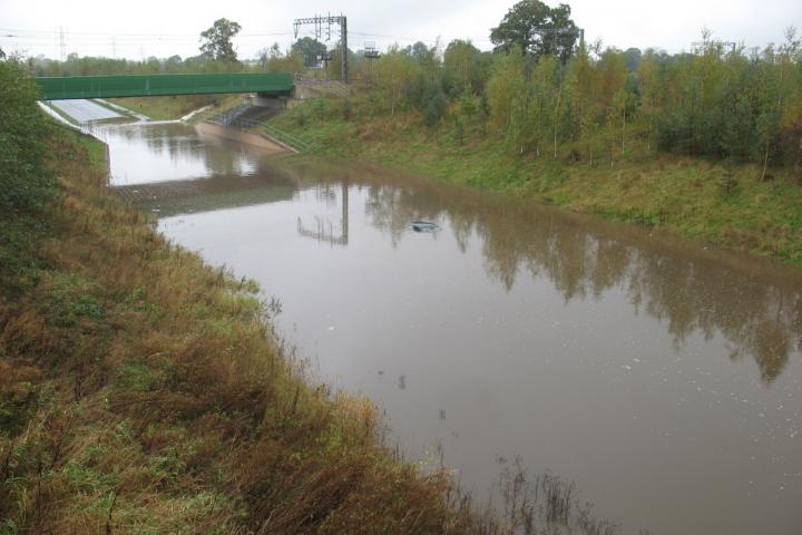
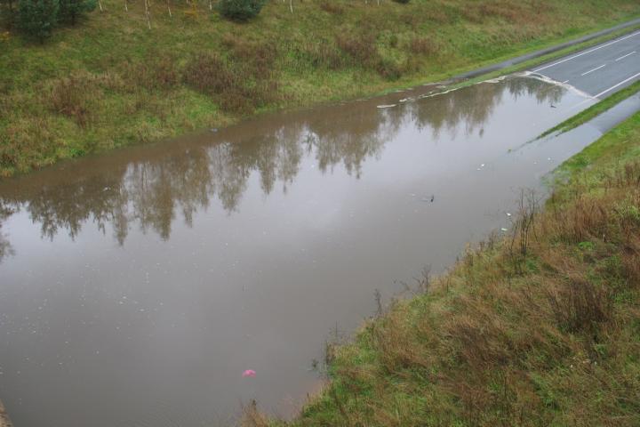
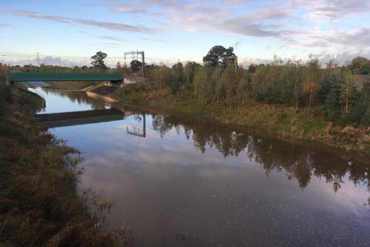
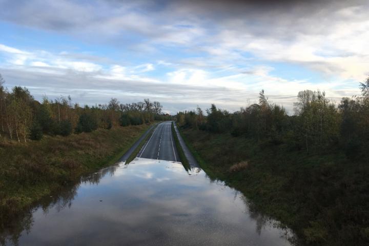
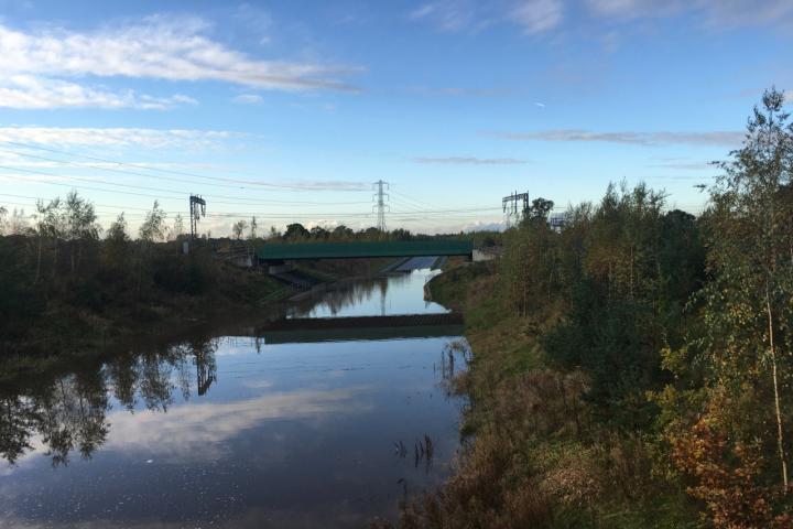
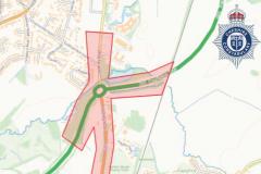
Many roads across East Cheshire are closed due to flooding including the A34 Alderley Edge Bypass (Melrose Way) as the carriageway is severely flooded.
The A34 Pendleton Way in Wilmslow is also closed in both directions between the Merlin Roundabout and Wilmslow High School.
Nigel Dibben took these photos today from the bridge over the bypass. The third photo shows the water pouring onto the road off Welsh Row.


Comments
Here's what readers have had to say so far. Why not add your thoughts below.
Or was it an "equipment failure" pump fault or similar
For this to occur twice in a short period of time then any contingency planning is not working
David Nuttall
One feature of all these underpasses is that they are below the water table - so they lie in a water proof trench which stops the ground water filling the trench and making it into a pond ! This does mean that water that gets into the trench must be pumped up and out and far enough away so that it flows away. The pumps are designed to deal with the rainwater flow that falls onto the road surface but I suspect not designed to deal with the situation where a torrent is flowing off the adjacent land into the water proof trench.
My guess is that the pumps were simply overwhelmed. Don't forget - we have experienced 20 years of climate change since the design specs for the pumps were settled.
I will see what the officers say in due course.
Melrose Way, Pendleton Way and the A555 all disrupted. The A555 only cost £300 million so I guess I'm expecting too much.
Unfortunately, roads which were built previously (e.g. Wilmslow & Alderley Edge bypass and even the more recent A6MARR) were only designed to withstand 1 in 30 year flood events, with little or no additional allowance for climate change. These events are, sadly, becoming more and more frequent.
This said, I am seeking a review of the Council’s existing gully-emptying policy, which for the last few years has been limited to emptying some gullies on an annual cycle, with many others not emptied at all or emptied only as part of targeted “clear and cleanse” days where requested.
Kind regards,
Craig
I live on Foden Lane and I have Mobberley Brook as part of my boundary. Since the bypass was built it regularly overflows its banks.
Foden Lane has standing water on it days after heavy rain.
Ok, maybe climate change is in play here but we don't help ourselves by allowing the grids and drains to clog up and not do anything about it.
Ah! The good old days.........
Perhaps we need to plan for a 1 in 100 year flood event every 5 years now?
This flood event in XXX years is unscientific crystal ball gazing. Get some engineering brains to sort out the problem along the following lines:
Florida gets lots of rain that mostly comes in sudden downpours. To disperse such sudden quantity of water by pumping directly off the roads would require a very high capacity pumping system [expensive too] with the danger that if a pump broke down the roads would not be cleared and flooding would result. Solution? Have an array of 'ponds' in the lower areas of land adjacent to the roads where water initially flows off the road surface and then pump it away over time - some of which is after the downpour has passed. These 'ponds' are interconnected so that if a pump fails the water can flow to another 'pond' and be dispersed by the pumps operating there.
The problem with the Alderley bypass is that the section of road in question is lower than the surrounding area in order to pass under the railway. I think it was decided not to go over the rail line so as to minimise the noise levels over in Alderley Edge. So the road sits in a ‘pond’ that cannot perhaps be emptied by the pumps, as they do not have the capacity to cope with a large downpour - or have become downgraded as a result of blockage or partial failure. A solution therefore is to dig a big hole to act as a ‘pond’ in the area next to where this flooding will occur in a heavy downpour and install several pumps that can still cope to empty the ‘pond’ even though half of them become incapacitated. Such a ‘pond’ will act like a reservoir or buffer zone to take the excess water off the road whilst the downpour is happening and prevent flooding on the road. The only factor to decide is the size of the ‘pond’ and a satisfactory array of pumps [plural] to empty it. A decent barrier to prevent vehicles falling into the ‘pond’ would also be a good idea. Had this concept been designed into the bypass when it was built the soil from the pond might not have been needed to be taken very far as it could possibly have been used on another part of the road construction.